Philly Track Strolls Vol. 1: the B&O/B&P
13 years 4 months ago #1
by shadowbat
Philly Track Strolls Vol. 1: the B&O/B&P was created by shadowbat
If you were wondering what I've been up to in the past couple of months, here you go. My explorations in 2012 have focused a lot less on buildings and more towards walking along the train tracks throughout Philly.
I have gotten hundreds of pictures (with more being taken pretty much every weekend) of various sections of rail lines both active and abandoned (plus adjacent attractions) so these series of threads will be ongoing with frequent updates. (also keep an eye on the graffiti section for posts there as well)")
The focus of this particular rail line the former Baltimore and Ohio (now CSX) running along the east side of the Schuylkill River. This is the one most easily accessible and has the coolest stuff so far so most of the updates will be here.
The B&O constructed this branch under it's Baltimore and Philadelphia subsidiary to gain unobstructed access to Philadelphia after loosing an 1881 bidding war with the Pennsylvania RR over control of the Philadelphia Wilmington and Baltimore RR, it's previous route of access. With the PW&B under PRR control, the "Pennsy" went out of their way to make things difficult for B&O (to put it lightly) and it was clear to B&O management that an alternate route of their own was needed.
After completion in 1886, passenger trains traveling on the B&P from points south would cross the river into Grays Ferry area of South Philly, continue north alongside the river into Center City where the main passenger terminal was an elaborate station designed by Frank Furness (architect of PRR's Broad Street Station five years earlier) located at 24th and Chestnut streets. Trains then continued north through what is now known as the "Art Museum Tunnel" and merged with the Reading, whose tracks B&O would use for points further out.
24th and Chestnut station:


Uploaded with ImageShack.us
The last passenger trains ran in 1958 and the station was demolished in 1963 following damage from a major fire. CSX now uses the line as part of it's Philadelphia division. In the 2000's the Center City portion of the Schuylkill Banks trail was developed in the space between the tracks and the river from the Art Museum down to Locust Street and has proven quite popular with joggers and cyclists.
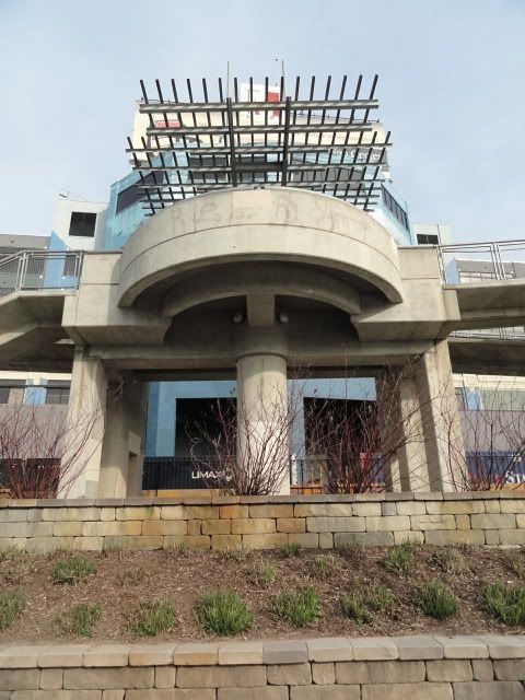
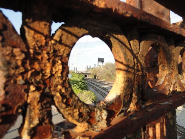
Part of the ramp system linking the Banks trail to the market and Chestnut Street bridges with a rolling freight barely visible through the supports....
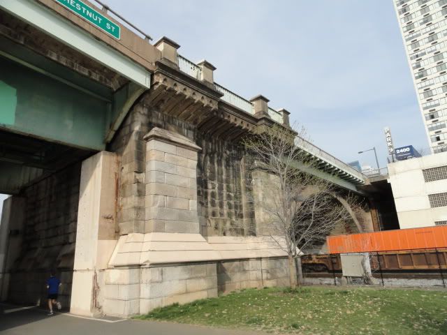
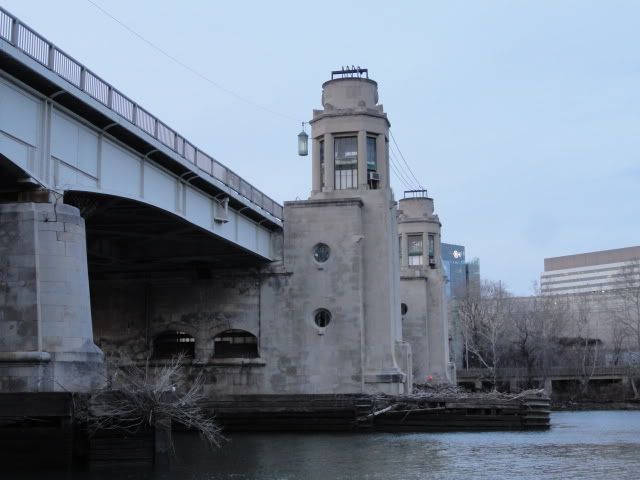
Chestnut Street bridge, the highrise 2400 Chestnut stands on the former Furness station site....
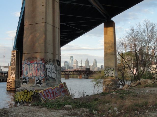
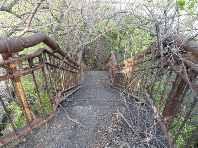
At the Locust street grade crossing the venture into the illegal begins.... ;D
A footbridge will open soon replacing the grade crossing at Locust. This was taken back in February, the main truss span has since been erected....
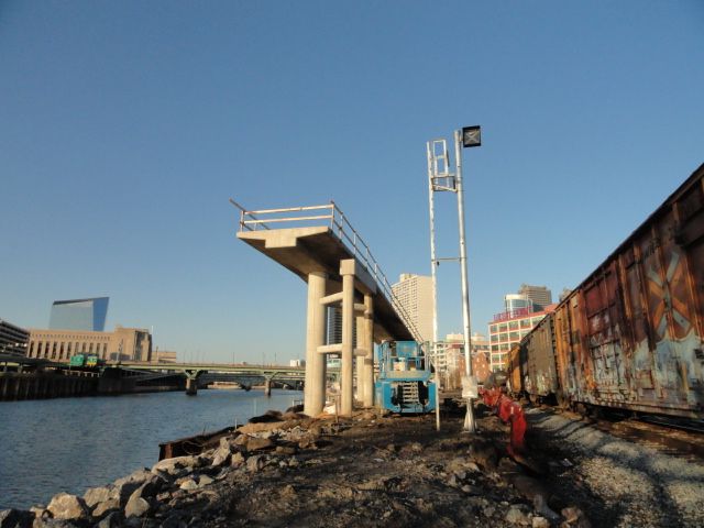
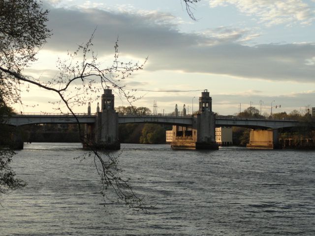
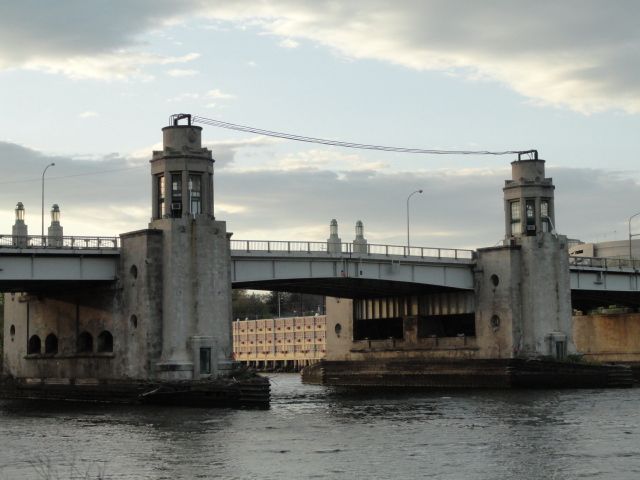
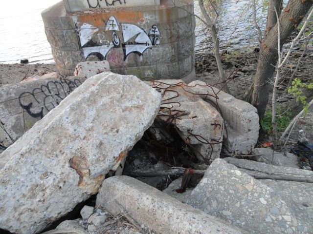
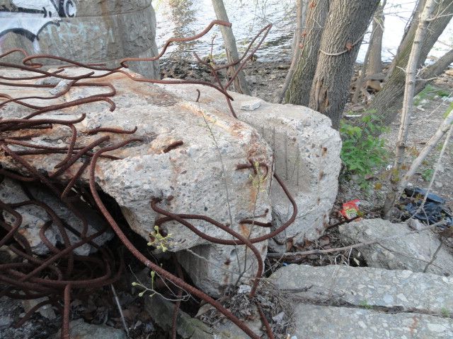
Under the new South Street bridge, the riverside foundation of it's predecessor used to stand where the rocks are now. A trail/boardwalk over the river will eventually extend from Locust to South...
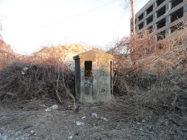
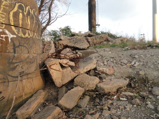
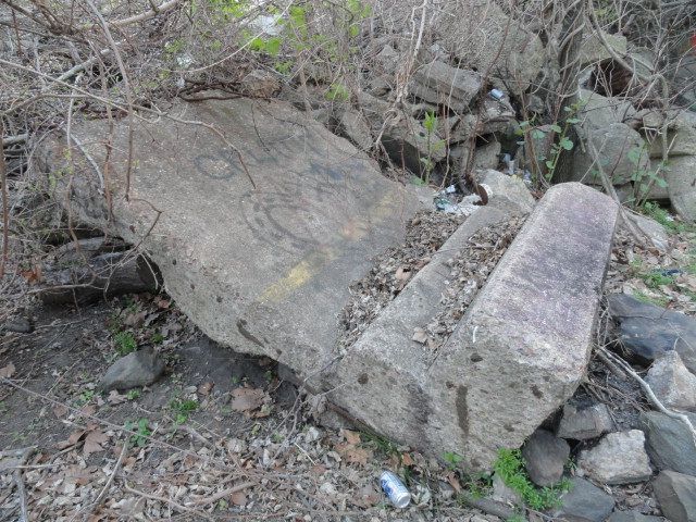
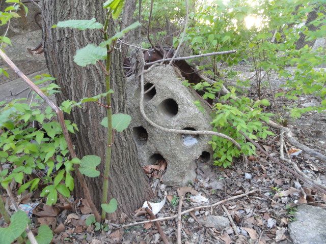
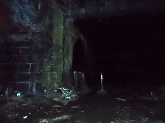
^This concrete structure has been boggling my mind for quite some time now. On my very first ventures here, years ago this was tipped on it's side, later it was righted. I figured at first that this was one of the drawbridge control towers of the old South Street Bridge that were removed when the bridge was clamped shut in the 1950's, but the actual control towers were of steel and glass. I think I read somewhere that this was actually a telephone booth for train crews, but I can't remember where I saw that info....
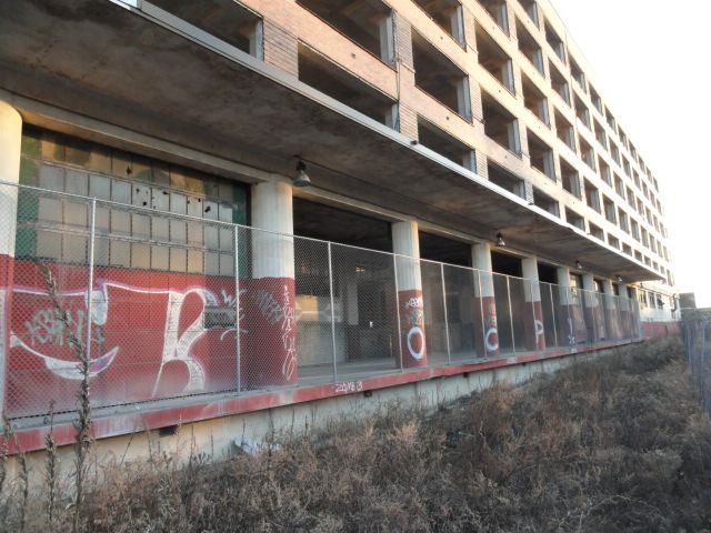
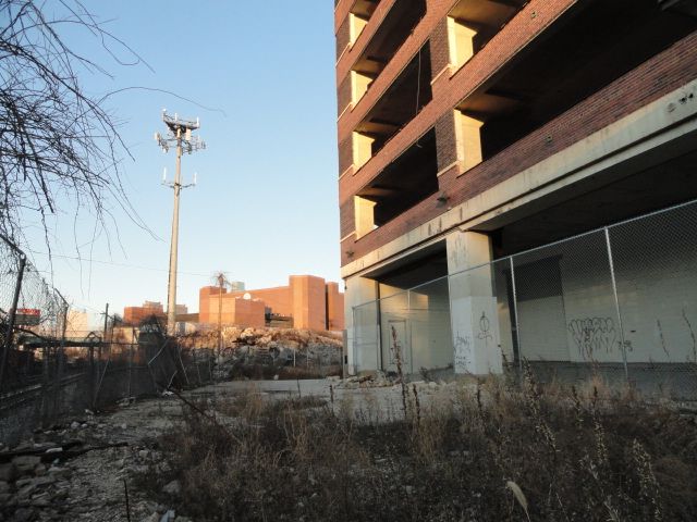
Continuing south one sees the monstrous South Bridge building. Constructed in 1941 by the US marines to manufacture tanks and munitions, the structure consists of extremely heavy duty concrete pillars and slabs. In 1965 the building was donated to the School district of Philadelphia and was used as the John F Kennedy Center, a vocational trade school. In 2005, the District sold the property to a developer who was set to transform it into one of the more unique condominium complexes in Philly. After being stripped completely bare, work was halted in 2007. The property is now owned by Children's Hospital of Philadelphia, who have stated that they were wanting to construct offices and research labs on the site. So far nothing has happened, and I personally believe that CHOP is just holding onto the land as an investment to fund it's ongoing construction on it's campus directly across the river....
^AT&T building seen in the background
More info here:
www.citypaper.net/blogs/nakedcity/PHILAP...k--South-Bridge.html
The building is accessible but stripped almost completely bare inside....
I have gotten hundreds of pictures (with more being taken pretty much every weekend) of various sections of rail lines both active and abandoned (plus adjacent attractions) so these series of threads will be ongoing with frequent updates. (also keep an eye on the graffiti section for posts there as well)
The focus of this particular rail line the former Baltimore and Ohio (now CSX) running along the east side of the Schuylkill River. This is the one most easily accessible and has the coolest stuff so far so most of the updates will be here.
The B&O constructed this branch under it's Baltimore and Philadelphia subsidiary to gain unobstructed access to Philadelphia after loosing an 1881 bidding war with the Pennsylvania RR over control of the Philadelphia Wilmington and Baltimore RR, it's previous route of access. With the PW&B under PRR control, the "Pennsy" went out of their way to make things difficult for B&O (to put it lightly) and it was clear to B&O management that an alternate route of their own was needed.
After completion in 1886, passenger trains traveling on the B&P from points south would cross the river into Grays Ferry area of South Philly, continue north alongside the river into Center City where the main passenger terminal was an elaborate station designed by Frank Furness (architect of PRR's Broad Street Station five years earlier) located at 24th and Chestnut streets. Trains then continued north through what is now known as the "Art Museum Tunnel" and merged with the Reading, whose tracks B&O would use for points further out.
24th and Chestnut station:

Uploaded with ImageShack.us
The last passenger trains ran in 1958 and the station was demolished in 1963 following damage from a major fire. CSX now uses the line as part of it's Philadelphia division. In the 2000's the Center City portion of the Schuylkill Banks trail was developed in the space between the tracks and the river from the Art Museum down to Locust Street and has proven quite popular with joggers and cyclists.
Part of the ramp system linking the Banks trail to the market and Chestnut Street bridges with a rolling freight barely visible through the supports....
Chestnut Street bridge, the highrise 2400 Chestnut stands on the former Furness station site....
At the Locust street grade crossing the venture into the illegal begins.... ;D
A footbridge will open soon replacing the grade crossing at Locust. This was taken back in February, the main truss span has since been erected....
Under the new South Street bridge, the riverside foundation of it's predecessor used to stand where the rocks are now. A trail/boardwalk over the river will eventually extend from Locust to South...
^This concrete structure has been boggling my mind for quite some time now. On my very first ventures here, years ago this was tipped on it's side, later it was righted. I figured at first that this was one of the drawbridge control towers of the old South Street Bridge that were removed when the bridge was clamped shut in the 1950's, but the actual control towers were of steel and glass. I think I read somewhere that this was actually a telephone booth for train crews, but I can't remember where I saw that info....
Continuing south one sees the monstrous South Bridge building. Constructed in 1941 by the US marines to manufacture tanks and munitions, the structure consists of extremely heavy duty concrete pillars and slabs. In 1965 the building was donated to the School district of Philadelphia and was used as the John F Kennedy Center, a vocational trade school. In 2005, the District sold the property to a developer who was set to transform it into one of the more unique condominium complexes in Philly. After being stripped completely bare, work was halted in 2007. The property is now owned by Children's Hospital of Philadelphia, who have stated that they were wanting to construct offices and research labs on the site. So far nothing has happened, and I personally believe that CHOP is just holding onto the land as an investment to fund it's ongoing construction on it's campus directly across the river....
^AT&T building seen in the background
More info here:
www.citypaper.net/blogs/nakedcity/PHILAP...k--South-Bridge.html
The building is accessible but stripped almost completely bare inside....
Please Log in or Create an account to join the conversation.
13 years 4 months ago #2
by shadowbat
Replied by shadowbat on topic Philly Track Strolls Vol. 1: the B&O/B&P
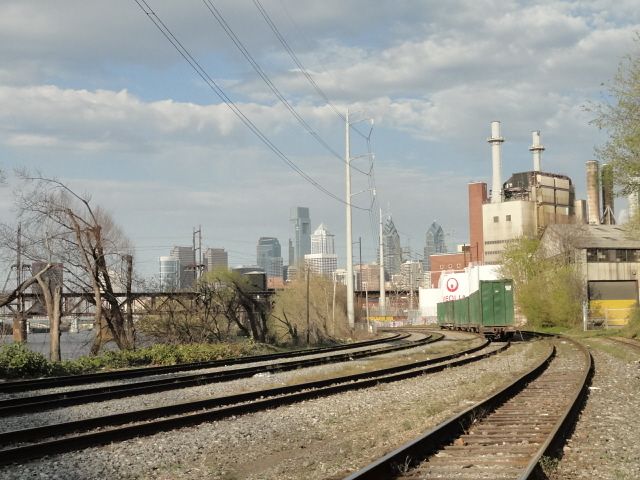
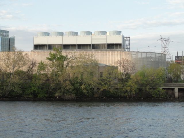
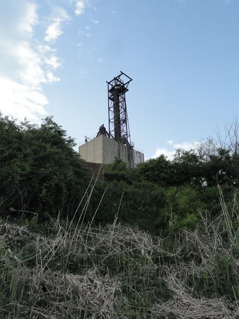
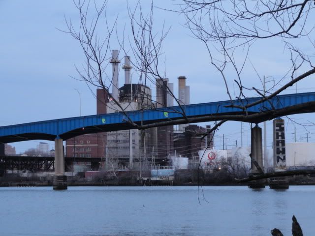
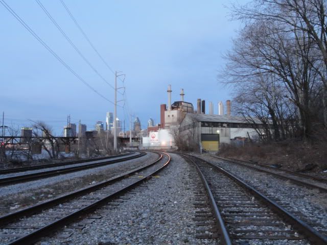
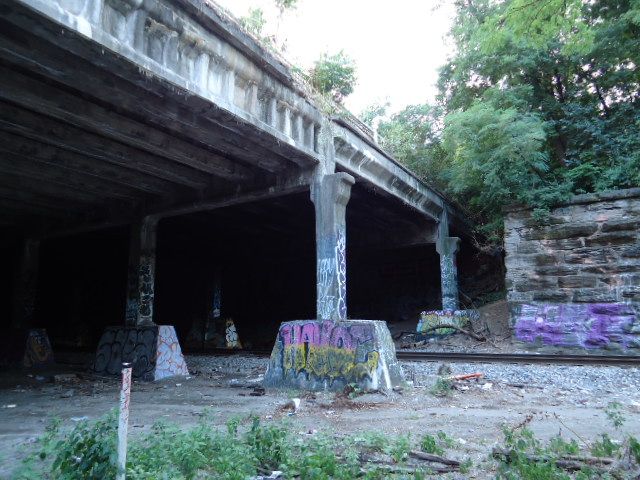
Spanning the tracks further south is a large structure that I'm assuming was used to unload coal from barges to feed the Schuylkill Generating station. First put into operation in 1903, (later expanded in 1914) this was the first of PECO's major power plants designed by John T Windrum....
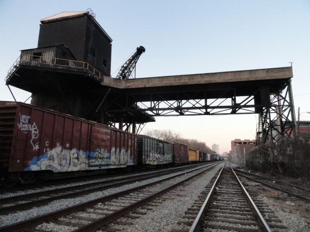
Although obviously not in use for a long time, the structure still has working lights inside and all access points from the tracks are sealed. the only way in is through the active power plant.
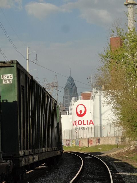
Immediately south is the PRR's Arsenal drawbridge. The first crossing here was a wooden truss bridge build in 1837 by the PW&B and named the Newkirk Viaduct. This was replaced in 1861 with an cast iron bridge. In 1885-86 the line's new owner PRR had the span replaced with the wrought iron wonder still in use today, also as part of CSX (the piers are from the 1861 structure)
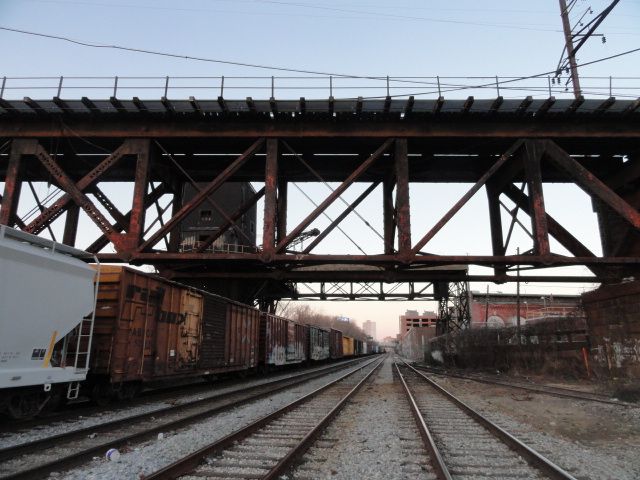
The site of the former United States Arsenal, the bridge's namesake stood immediately south of the elevated viaduct. PECO transformer yards and Veolia steam now occupy the site....
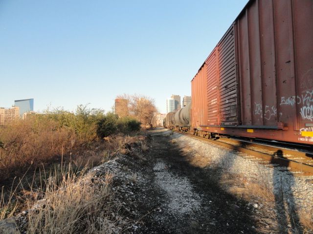
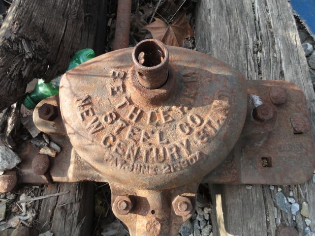
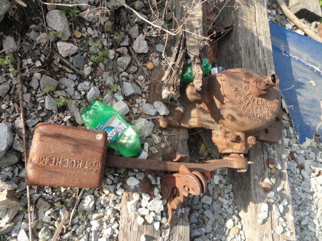
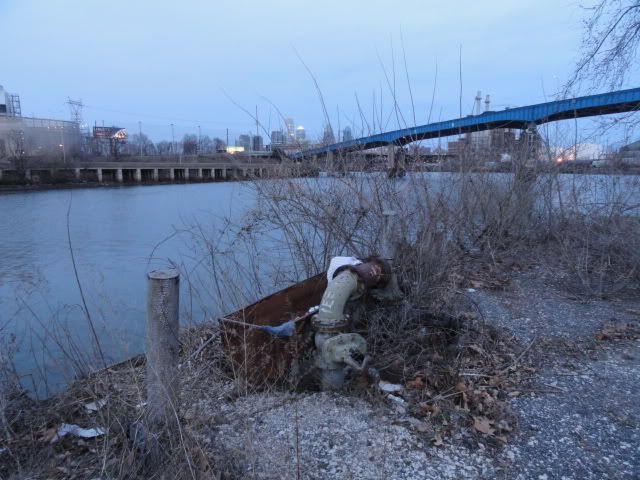
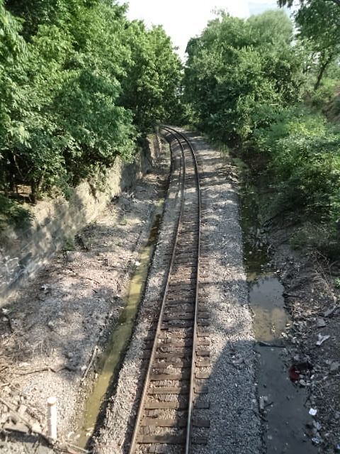
Moving down past I-76-the next river crossing-the land between the tracks and the river widen as the line travels toward the intersection of Greys Ferry and University Avenues. This swath of land used to house industry of some sort. Two trailers used to sit here containing some slightly cool stuff until they were burned down not too long ago. Eventually the banks project will reach through this area as it extends from South Street to link up with the Dupont Crescent trail further down....
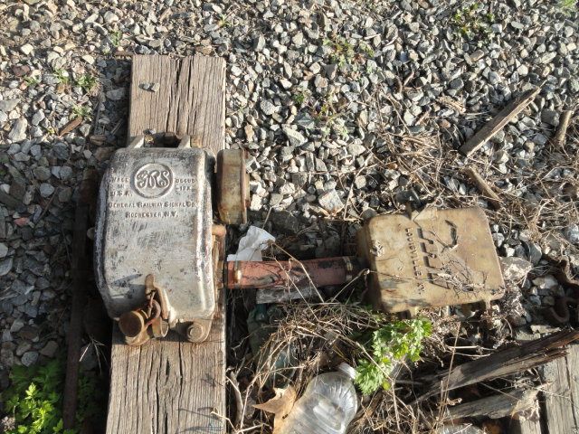
A disused switch leading to a spur that once serviced the area....
Although obviously not in use for a long time, the structure still has working lights inside and all access points from the tracks are sealed. the only way in is through the active power plant.
Immediately south is the PRR's Arsenal drawbridge. The first crossing here was a wooden truss bridge build in 1837 by the PW&B and named the Newkirk Viaduct. This was replaced in 1861 with an cast iron bridge. In 1885-86 the line's new owner PRR had the span replaced with the wrought iron wonder still in use today, also as part of CSX (the piers are from the 1861 structure)
The site of the former United States Arsenal, the bridge's namesake stood immediately south of the elevated viaduct. PECO transformer yards and Veolia steam now occupy the site....
Moving down past I-76-the next river crossing-the land between the tracks and the river widen as the line travels toward the intersection of Greys Ferry and University Avenues. This swath of land used to house industry of some sort. Two trailers used to sit here containing some slightly cool stuff until they were burned down not too long ago. Eventually the banks project will reach through this area as it extends from South Street to link up with the Dupont Crescent trail further down....
A disused switch leading to a spur that once serviced the area....
Please Log in or Create an account to join the conversation.
13 years 4 months ago #3
by shadowbat
Replied by shadowbat on topic Philly Track Strolls Vol. 1: the B&O/B&P
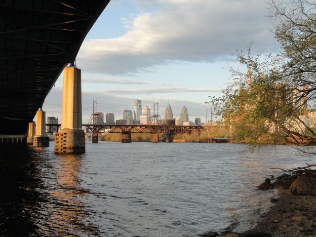
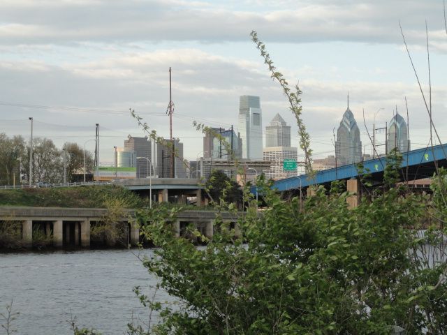
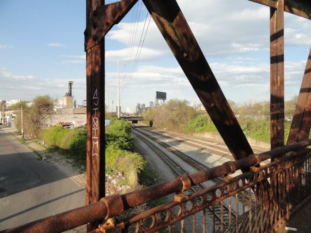
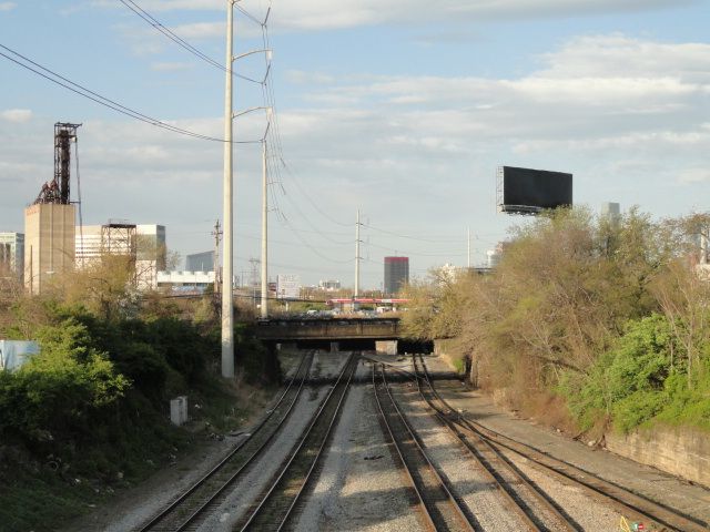
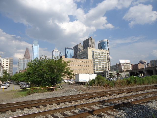
The site does have some awesome views going for it and gives a unique foreground to the classic Philly skyline shot....
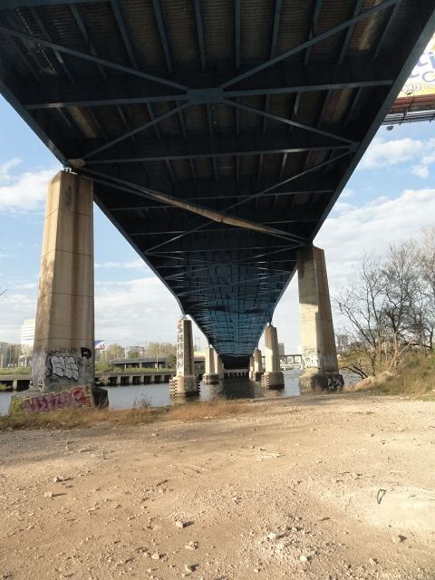
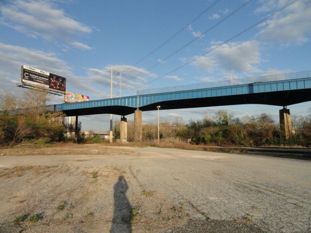
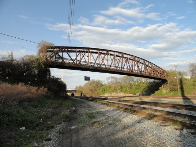
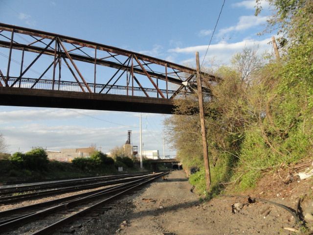
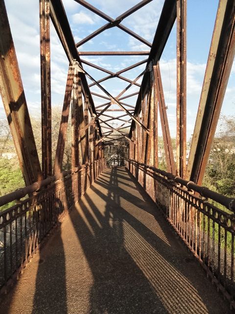
University Avenue Bridge, built in 1929 to the design of Paul Cret....
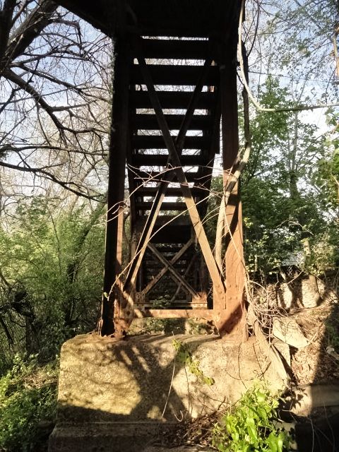
Poking around the I-76 supports I noticed a rather odd pile of rubble near the north pillar. Upon closer examination, I discovered that this was part of the old road deck that was removed when the bridge was refurbished in the late 2000's. Instead of hauling it off, PennDot simply dumped it here.... :")
^You can see the yellow line here clearly....
^Where fence posts were mounted....
^If you look closely you can see the rivet heads where the concrete joined the steel girders....
University Avenue Bridge, built in 1929 to the design of Paul Cret....
Poking around the I-76 supports I noticed a rather odd pile of rubble near the north pillar. Upon closer examination, I discovered that this was part of the old road deck that was removed when the bridge was refurbished in the late 2000's. Instead of hauling it off, PennDot simply dumped it here.... :
^You can see the yellow line here clearly....
^Where fence posts were mounted....
^If you look closely you can see the rivet heads where the concrete joined the steel girders....
Please Log in or Create an account to join the conversation.
13 years 4 months ago #4
by shadowbat
Replied by shadowbat on topic Philly Track Strolls Vol. 1: the B&O/B&P
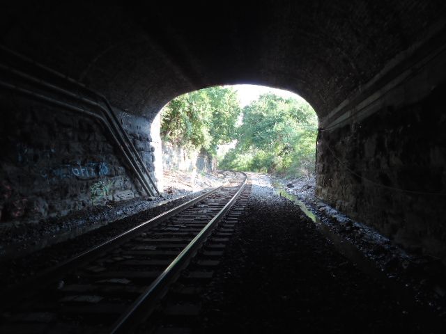
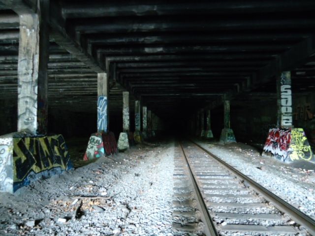
Moving further down, the tracks pass through a tunnel that straddles the intersection of Grays Ferry and 34th st /University Ave crossing at a diagonal. As congestion increased, the 1886 tube was joined by two other passages in 1918.
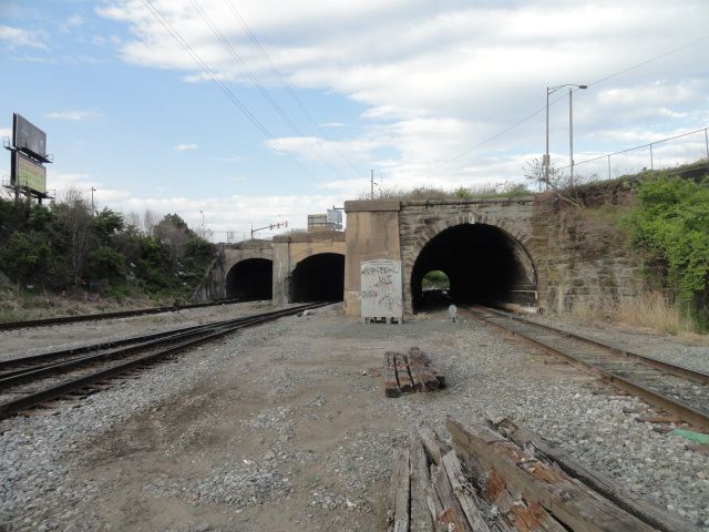
(Oldest one on right.)
Between the tunnels and the Wharton St overpass is the former Manufacturing Dry Goods company silo (more on that later)
The next street, Reed, is marked by a former foot bridge.
Steel bars, long overgrown block access from from both sides and the former street on the eastern side no longer exists, usurped into the property of a trucking yard....
Someone did cut away some bars on the eastern end, allowing access upon the span itself....
Past Reed, the line splits into two, with the former B&P mainline spanning the Schuylkill to continue it's journey south to Baltimore. The other line traveling through a large yard in Point Breeze, and then joining the former PRR 25th street freight line ending at the massive Greenwich Yard by the stadiums. I thought I had a shot of the Point breeze yard somewhere, but I guess not....
Please Log in or Create an account to join the conversation.
13 years 4 months ago #5
by shadowbat
Replied by shadowbat on topic Philly Track Strolls Vol. 1: the B&O/B&P
Some older shots from the area between I 76 and Uni Ave that I forgot about....
Schuylkill power in all it's glory....
U. Ave. bridge up close and personal....
^Yep ;D
Schuylkill power in all it's glory....
U. Ave. bridge up close and personal....
^Yep ;D
Please Log in or Create an account to join the conversation.
13 years 4 months ago #6
by shadowbat
Replied by shadowbat on topic Philly Track Strolls Vol. 1: the B&O/B&P
After being preoccupied with other things for way too long, I took advantage of my much needed vacation in early July to cover some serious ground. Finally starting to get pics up now....
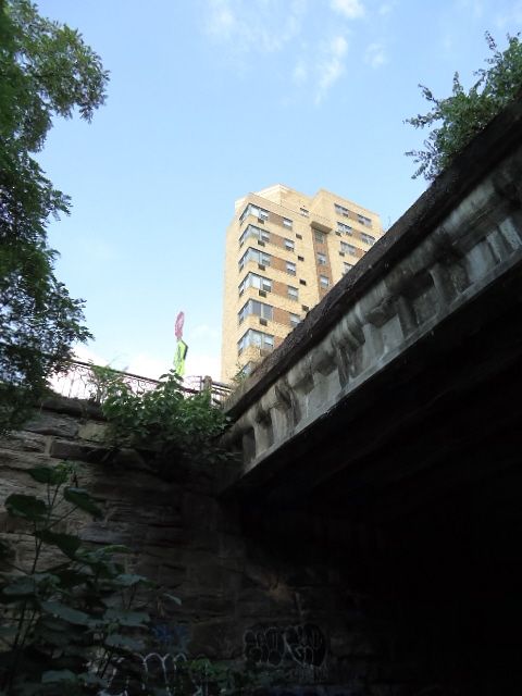
Skyline shot from the trail side in Center City:
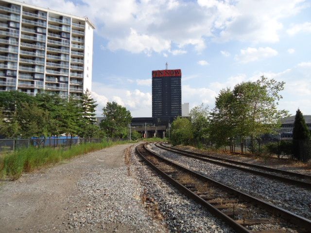
^Peco HQ building.
The B&O line passes under Fairmount Hill constructed in 1886, though the portal reads 1921. I'm assuming it was rebuilt as party of the Ben Franklin Parkway

This tunnel heads north directly under Eakins Oval at the foot of the Art Museum (also passing under the Spring Garden Street traffic tunnel) before curving to the northwest, emerging from a portal right next to the Reading RR's Pennsylvania Ave Tunnel (city branch line)
Warning shitty flash photos ahead
^B&O tunnel northwest portal
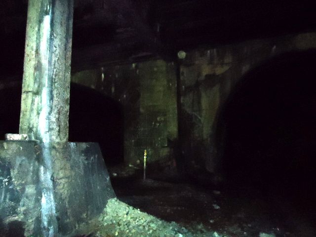
^Part of the "City Branch" portal on the left
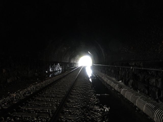
This particular tunnel was built from 1894 to 1900 as part of a project to eliminate grade crossings (I'll save the more in depth history for a future post) and saw it's last train run in 1992. During it's heyday trains traveled through here from the Reading passenger terminal at 12th and Market and freight terminal at Broad and Callowhill to points north and west.
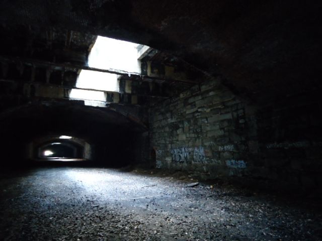
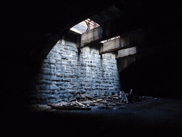
^Inside the tunnel with multiple air shafts-necessary in the era of steam. These were later narrowed down when Pennsylvania Blvd above was widened.
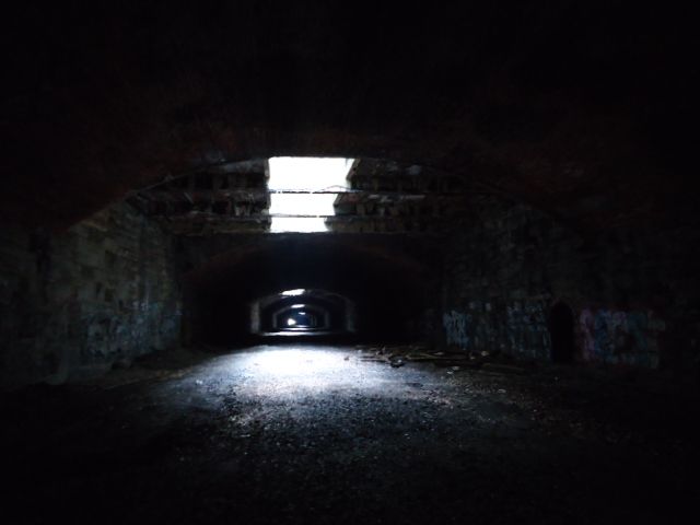
The stretch east of here was taken over by the PPD as a parking lot of their precinct which was built directly above so this is the point where I turned back....
Out to the west, the Reading and B&O tracks were covered over by a steel and concrete deck extending the Boulevard an additional block....
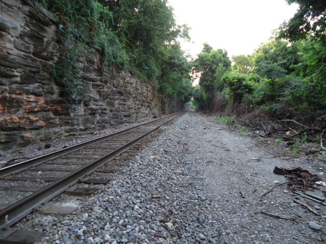
Continuing northward towards Columbia Bridge....
Finally starting to get pics up now....Skyline shot from the trail side in Center City:
^Peco HQ building.
The B&O line passes under Fairmount Hill constructed in 1886, though the portal reads 1921. I'm assuming it was rebuilt as party of the Ben Franklin Parkway
This tunnel heads north directly under Eakins Oval at the foot of the Art Museum (also passing under the Spring Garden Street traffic tunnel) before curving to the northwest, emerging from a portal right next to the Reading RR's Pennsylvania Ave Tunnel (city branch line)
Warning shitty flash photos ahead
^B&O tunnel northwest portal
^Part of the "City Branch" portal on the left
This particular tunnel was built from 1894 to 1900 as part of a project to eliminate grade crossings (I'll save the more in depth history for a future post) and saw it's last train run in 1992. During it's heyday trains traveled through here from the Reading passenger terminal at 12th and Market and freight terminal at Broad and Callowhill to points north and west.
^Inside the tunnel with multiple air shafts-necessary in the era of steam. These were later narrowed down when Pennsylvania Blvd above was widened.
The stretch east of here was taken over by the PPD as a parking lot of their precinct which was built directly above so this is the point where I turned back....
Out to the west, the Reading and B&O tracks were covered over by a steel and concrete deck extending the Boulevard an additional block....
Continuing northward towards Columbia Bridge....
Please Log in or Create an account to join the conversation.